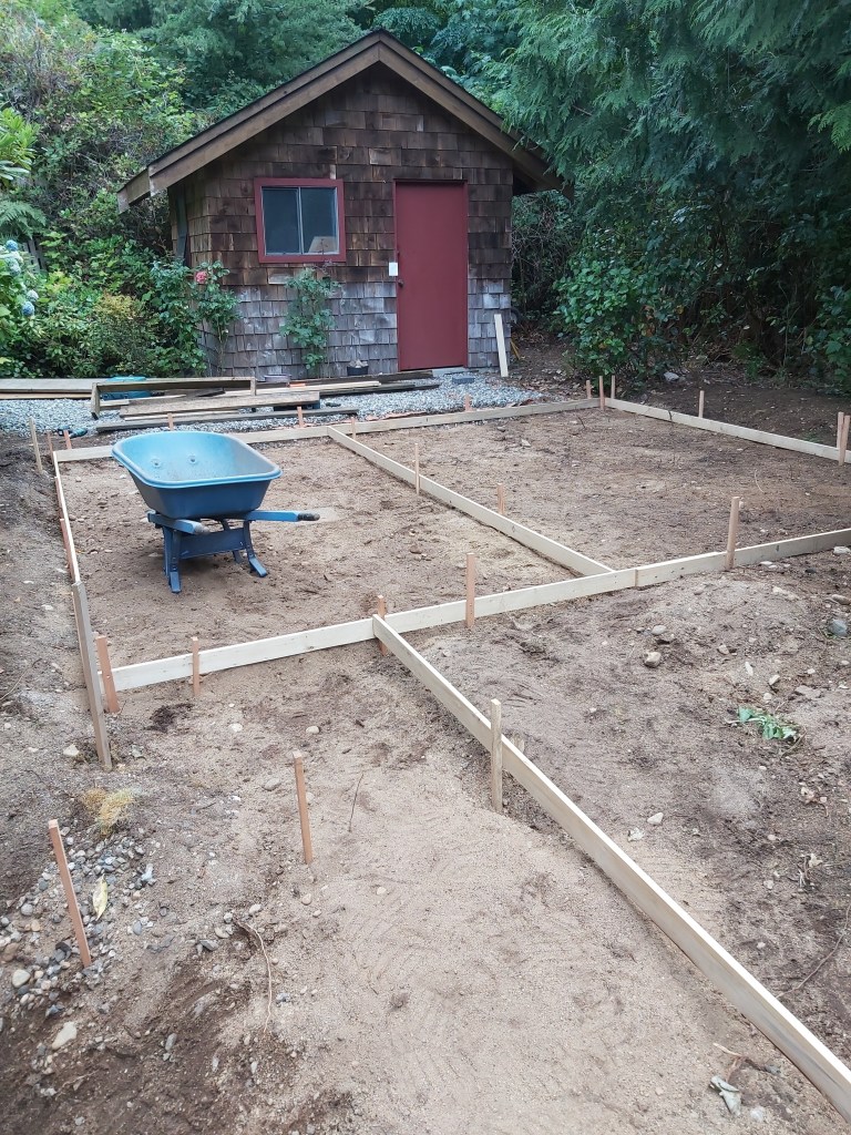
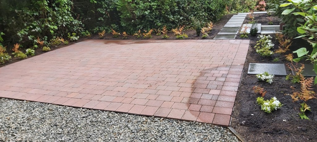
Before and After: An under-used corner of garden was renewed with a patio installation and plantings.
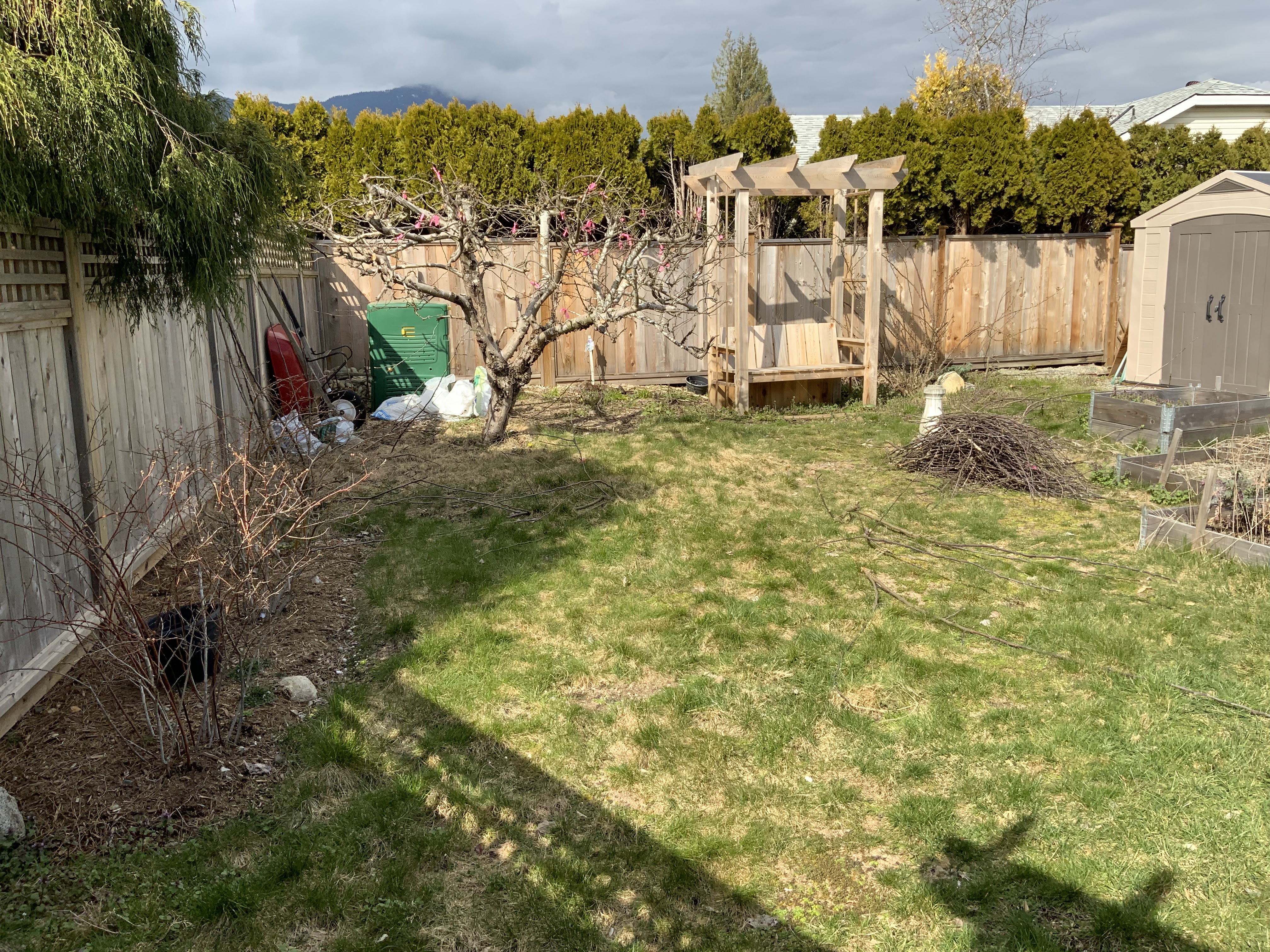
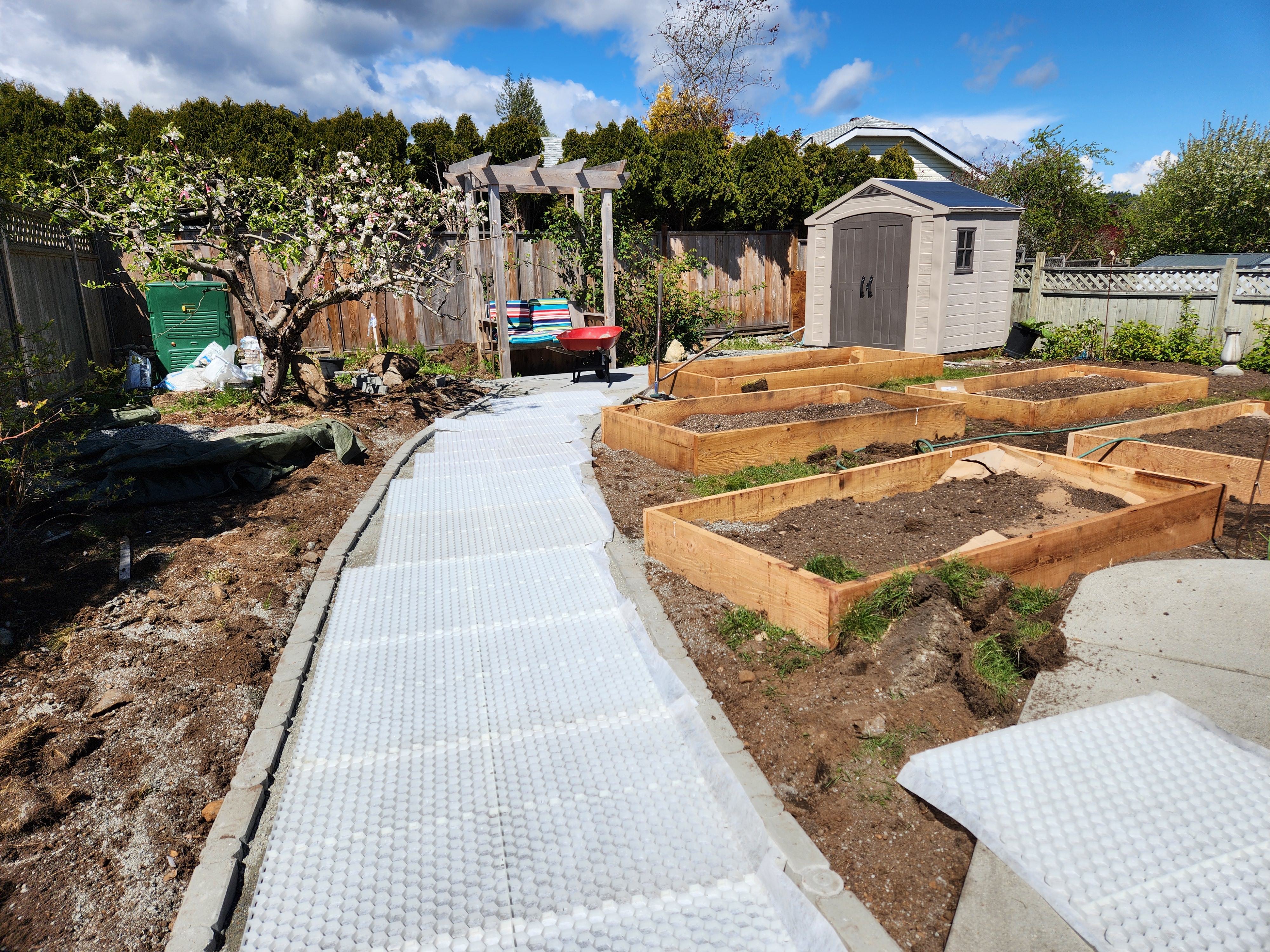
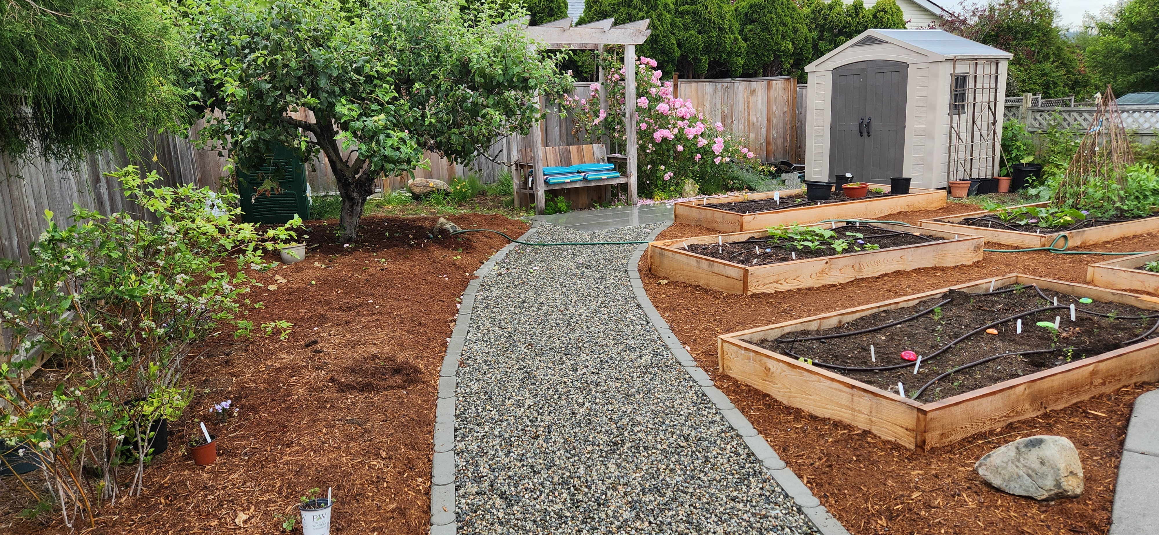
Before and After: Lawn removed. A CORE pathway was installed for wheelchair accessibility. We added all new veggie beds and drip irrigation. All other areas were mulched for a low maintenance garden. Plantings included blueberries, and flowering pollinator plants.

Through a small grant provided by the Ontario Public Interest Group Guelph (or OPIRG-Guelph), I designed and published 1000 copies of this Green Map for university students. The Green Map System is a community map-making process, that uses accessible tools and universal icons to identify green living sites, and natural, cultural and social resources. I chose to focus on only the downtown and near the university, and tried to show diverse places that represented the Guelph I knew. Some of the sites I mapped were foot bridges, special trees, green businesses, walking trails, boulevard gardens, wetlands and community gardens. Check out www.greenmap.org to be inspired by community map makers around the world! This was put together with aerial maps, and Adobe Illustrator.

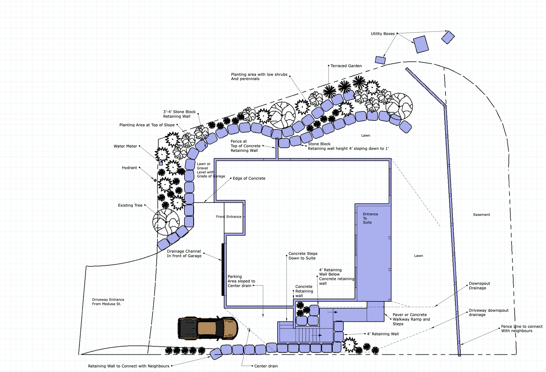
While working with a local Landscape Architect, we developed this planting plan. This was drafted in VectorWorks and includes a proposed veggie garden area, plantings to create privacy from an alley, eco-paving for parking spots, and a gathering space for outdoor events.

Inspired by the client who is a contemporary industrial designer, I came up with this design palette for her front garden. Using photos of plants from my own collection as well as images collected from the web, I was better able to describe the vision to client. This was given in conjunction with a hand-drawn plan-view concept sketch.


Here are a few examples of different drawings I have done in Sketch-up and Morpholio Trace. From concept plans, planting plans, construction drawings, and development permit drawings,
Before and After: Lawn removed. A CORE pathway was installed for wheelchair accessibility. We added all new veggie beds and drip irrigation. All other areas were mulched for a low maintenance garden. Plantings included blueberries, and flowering pollinator plants.
